2023
GeoDirectUS

|
|
|
|
|
|
|
|
|
|
|
|
|
|
|
|
|
|
|
|
|
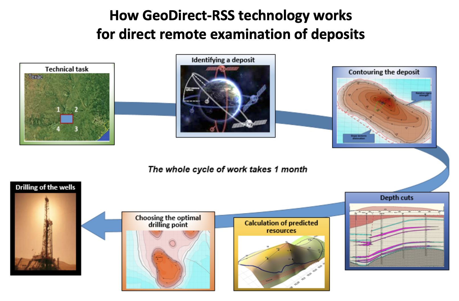
We're ready to survey blocks up to 10,000 sq. km and provide a final report with the following data:
▪ Ground contours ▪ Limits for extension of traps ▪ The number & depth of horizons
▪ Presence of a gas cap over the oil horizon ▪ Reservoir pressure
▪ Presence of water under an oil horizon ▪ Vertical scan data column
▪ Vertical sections of reservoirs ▪ Roof structural maps & Volume for individual layers
▪ Mapping the maximum signal response ▪ Identification of optimal drilling points
The survey period is ~1.5 months

Hello@GeoDirectUS.com
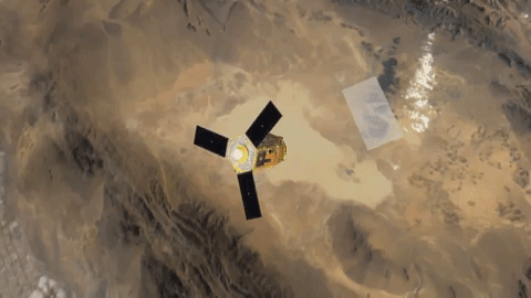
Our high-tech innovative method for the evaluation of hydrocarbon deposits, accumulations and flows of freshwater/thermal water, and various minerals (gold, silver, platinum, diamonds, etc.) down to a depth of up to 7 km. The proposed method of mineral deposits refers to Direct geophysical methods of geology.
The method, technology, and the corresponding equipment were developed by qualified scientists based on the latest achievements of science and technology in the field of nuclear physics, the theory of propagation of radio waves, computer science, and radio engineering.
The method is called "Resonance Spectral Survey" (RSS) and gives positive practical results for remote search and exploration of hydrocarbon deposits, fresh and thermal waters, as well as other minerals on the territory of different countries for over 10 years.
The detection and exploration of deposits using our methodology offers a significant savings in money & time, as it almost completely replaces the traditional geophysical, geochemical, and geological search and exploration works on prospecting and exploration of deposits, estimation of mineral resources and selection of optimal points for subsequent exploration and exploitation drilling.
In addition to saving the client’s time and money, our method provides a higher, in comparison with traditional approaches, performance of oil/gas/mineral exploration, both onshore and offshore in deserts, mountain plains, wet/mangrove forests, etc.
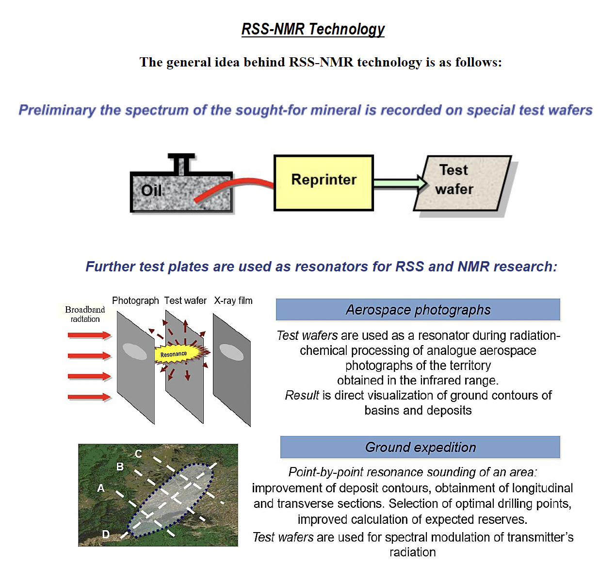
The method is based on the phenomenon of resonance, which allows direct detection and contouring of hydrocarbon deposits, as well as deep sounding and obtaining data on the occurrence of horizons, the presence of gas caps, the gas pressure in them, watering of horizons, to choose the optimal points for drilling, and to calculate the forecast hydrocarbon resources.
The technology provides various types of services and can highly efficiently survey the entire territory of the client’s block/blocks even before obtaining a license and indicate their availability:
• An operative remote survey of licensed blocks (hundreds, thousands, and more km2) in order to identify and delineate mineral deposits is a "Diagnostics" of sites.
• Detailed remote survey of identified deposits in order to obtain data on the occurrence of horizons, determine optimal drilling points and calculate predicted resources of the deposit.
• Detailed control of the points planned for drilling.
Each of the stages is self-sufficient and can be carried out separately, and also in conjunction with other stages depending on the tasks assigned.
Summary